54°4'0" N
4°36'0" W
~0m asl
04:07 (BST - UTC/GMT+1)
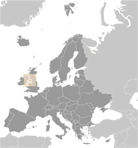
Saint Michaels Island (Saint Michaels Island) est un/une île (class T - hypsographiques) en Isle of Man (Isle of Man (general)), Isle Of Man [ Royaume-uni ] (Europe), ayant le code de région Americas/Western Europe...
Saint Michaels Island est aussi connu(e) comme Saint Michael Island, Saint Michaels Island.
Les coordonnées géographiques sont 54°4'0" N et 4°36'0" W en DMS (degrés, minutes, secondes) ou 54.0667 et -4.6 (en degrés décimaux). La position UTM est UE99 et la référence Joint Operation Graphics est NN30-04.
L’heure locale actuelle est 04:07; le lever du soleil est à 07:53 et le coucher du soleil est à 20:00 heure locale (Europe/Isle_of_Man UTC/GMT+1). Le fuseau horaire pour Saint Michaels Island est UTC/GMT+0, mais le fuseau horaire actuel est UTC/GMT+1, parce qu’en ce moment l’heure d’été (DST) est valable.
En 2024 l’heure d’été est valable de 31 Mar 2024 à 27 Oct 2024.
A île est une parcelle de terrain, plus petit qu'un continent, entourée par l'eau à marée haute.
|
Advertisements:
Advertisements:
|
Météo Saint Michaels Island (Nébulosité, Température, Vent et Précipitation mm probab.)
Sat
Apr 27
8 °C min
9 °C max
10 km/h
Thu Jan 1
|
Sun
Apr 28
~0.3 l/m2 13%
6 °C min
10 °C max
32 km/h
Thu Jan 1
|
Mon
Apr 29
~16 l/m2 75%
8 °C min
11 °C max
56 km/h
Thu Jan 1
|
Tue
Apr 30
~19 l/m2 96%
9 °C min
13 °C max
42 km/h
Thu Jan 1
|
Wed
May 1
~3 l/m2 58%
10 °C min
12 °C max
29 km/h
Thu Jan 1
|
Thu
May 2
~1 l/m2 54%
10 °C min
13 °C max
32 km/h
Thu Jan 1
|
|
|
Saint Michaels Island (Isle of Man) prévisions à 7 jours
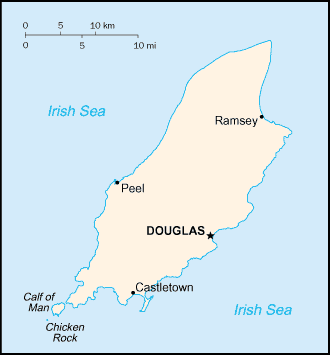
Carte et Les photos Saint Michaels Island
--- Il n'y a aucun commentaire ---
Ajouter un commentaire:
|
Login
Isle Of Man [ Royaume-uni ] (British Crown Dependency):
Advertisement
Points GPS pres de Saint Michaels Island
Points GPS de Isle Of Man [ Royaume-uni ] (British Crown Dependency)
|
 Derby Haven (2 km)